3 numbers. 2 separate processes. 1 chance to respond before 6 May.
The evidence on this page raises five questions that Hertsmere Borough Council must answer before approving 550 homes on the former Potters Bar Golf Course. Read the summary, download the documents, and then use the objection builder to make your voice heard.
Use the objection builder →1. The numbers that don't add up
Three different figures have been put forward for how many homes can be built on this site. Nobody has publicly explained the gap between them.
What this means: A consultant working for the developer on a nearby application used Hertsmere's own planning database to assess all sites for flood risk and capacity, including the former golf course. After filtering out land with significant flood risk — as planning policy requires — they assessed the site as having room for 42 to 59 homes. That assessment is not binding on this application, but it is the only such assessment that has been identified by PottersBar.Vision in the public record. Hertsmere has not yet produced its own independent study and there is no published explanation or reconciliation of the 42–59 assessment with the 400-home Local Plan figure or the 550-home application.
2. The flood risk
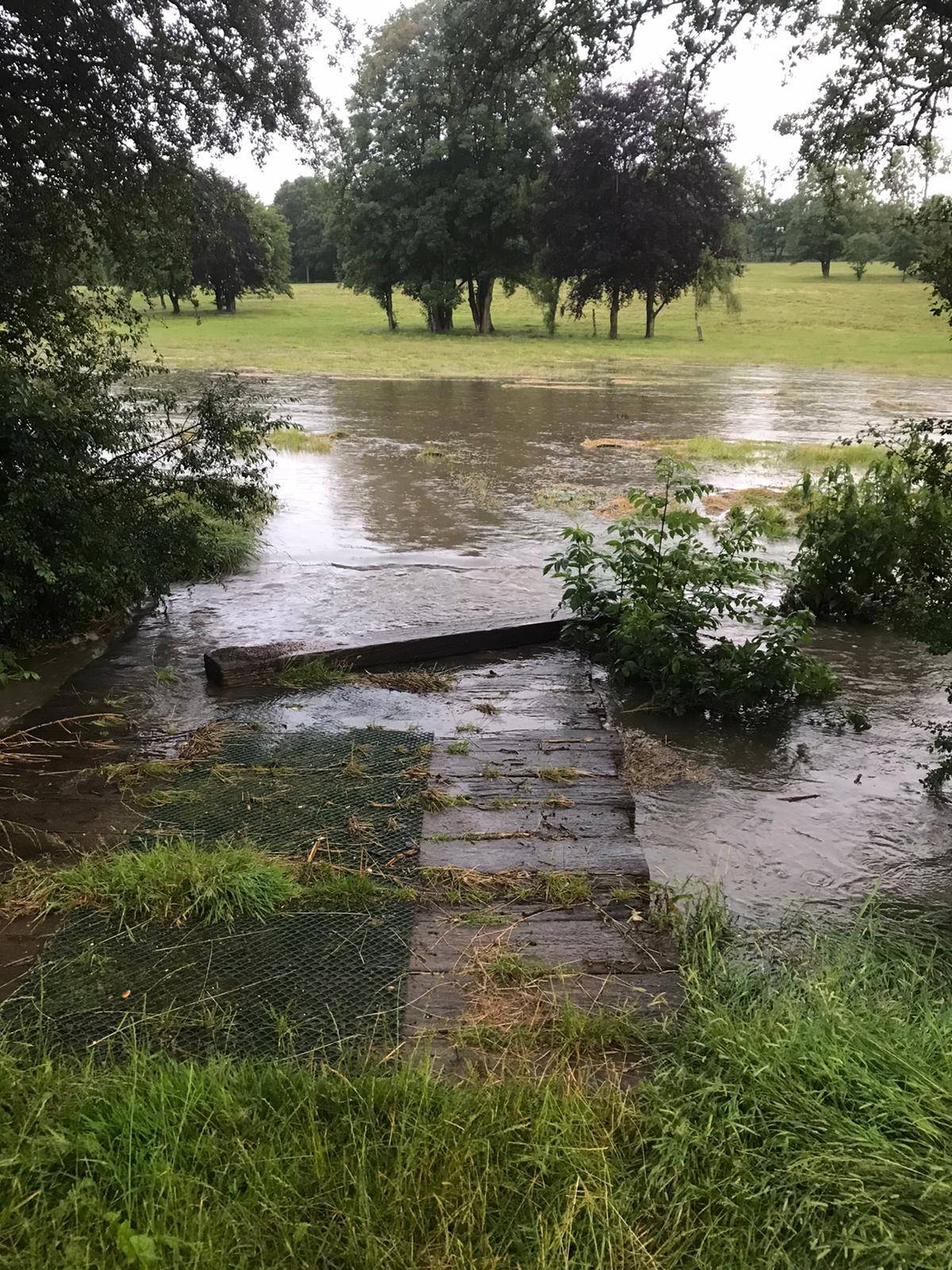
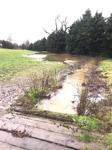
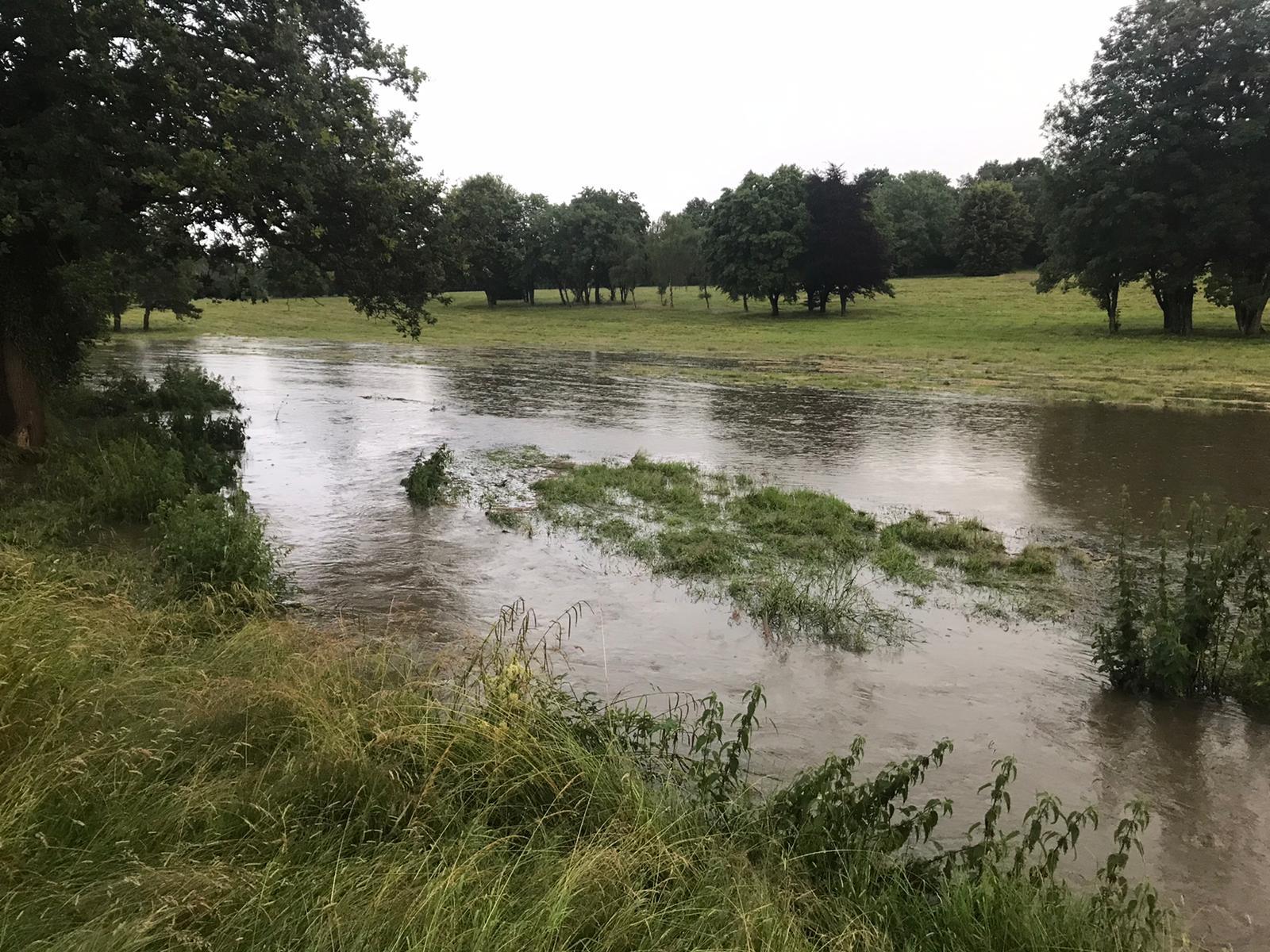
The site
Potters Bar Brook, an Environment Agency Main River, crosses the site through a central valley that has HIGH documented flood risk. Potters Bar recorded 32% of Hertsmere flooding incidents between 2002 and 2015 — a disproportionately high share for one location.
The access road
Darkes Lane is the only vehicular access to the site. It is vulnerable to flooding. There is no secondary vehicular access.
The railway tunnel at the western boundary is pedestrian-only and would be subject to Network Rail restrictions. It is unsuitable as an emergency vehicle access.
The planning policy test
National planning policy (NPPF paragraph 181(e)) requires that safe access and escape routes are maintained for the lifetime of a development. On a site where the only road access floods, that requirement has not been demonstrated to be met.
The PB3 comparison
In December 2025, Hertsmere refused a nearby Green Belt planning application (24/1101/OUTEI — referred to as "PB3") partly because the Flood Risk Sequential Test had not been satisfied. That site has a better flood profile than the golf course. Hertsmere needs to explain why the same test is not an obstacle here.
What this means: The only road into this site is in a flood zone. There does not appear to be a back-up route for emergency vehicles. Planning policy is clear that safe access must be guaranteed for the lifetime of any development — that has not been demonstrated here. A nearby scheme was refused on flood risk grounds in December 2025, and the golf course has a far worse flood risk profile than that site.
3. The Environment Agency correspondence
Pre-application correspondence between the developer and the Environment Agency (released under EIR2026/12448) raises important questions about whether the site's watercourse issues have actually been resolved.
The bridge requirement: From December 2023 onwards, the Environment Agency required that any crossing of Potters Bar Brook on this site must use open-span bridges — not culverts. Open-span bridges are significantly more expensive and technically complex than culverts.
Those bridge designs have no evidence they have been produced or reviewed. The EA's pre-application correspondence letters are advice only — they expressly state the EA reserves the right to change its position at any formal application stage. They are not planning clearance.
The consultation process: Documents released under the Environmental Information Regulations (EIR2026/12448) show that the golf course site was included in the April 2024 Local Plan consultation while flood and access modelling for the site entrance remained incomplete and unreviewed by the Environment Agency.
In plain terms: the site was put forward for 400 homes in a public consultation before the Council's own technical review of the flood access issues was complete.
What this means: The Environment Agency's letters saying the developer's early plans look "acceptable" are not approvals — they are advice that can be withdrawn. The critical engineering work (designing the bridges over Potters Bar Brook) has no evidence it has been done. And when Hertsmere asked residents whether 400 homes should be built here in 2024, the Council's own flood review wasn't finished. Residents were consulted on an incomplete picture and the same seems to be happening again.
4. The Thames Water evidence
Information released by Thames Water under EIR-23-24-626 (4 March 2024) raises unresolved questions about drainage capacity and groundwater protection on the site.
- A 630m³ foul water storage tank sits under the former golf course car park.
- That tank has a consented storm overflow permit (TEMP.2548) that discharges into Potters Bar Brook and creates a risk to adjacent properties as well as the brook.
- The site is within EA Source Protection Zone I — the highest level of groundwater protection, serving drinking water sources.
- The developer's own planning documents acknowledge that Thames Water foul drainage capacity for 550 homes is unconfirmed.
What this means: Before 550 homes can be connected to the foul sewer, Thames Water must confirm capacity exists. That confirmation has not been given. Building 550 homes on a site in a groundwater protection zone, with a pre-existing overflow into a protected watercourse and a risk to adjacent properties as well, and without confirmed drainage capacity, poses a risk to both public health and the environment that has not been adequately addressed.
5. The PB3 comparison
In December 2025, Hertsmere Borough Council refused planning application 24/1101/OUTEI — a proposal for a large Green Belt housing development south of Potters Bar, known as "PB3". One of the grounds for refusal was that the Flood Risk Sequential Test had not been satisfied.
The Sequential Test is a planning policy requirement: before a site with flood risk can be approved for development, the applicant must show that there are no reasonably available alternative sites with lower flood risk. PB3 failed this test — meaning the council believed that there were lower-risk alternatives available.
What this means: Hertsmere recently refused permission for a similar scheme on a site with better flood figures than the golf course, specifically because it couldn't pass the sequential test. The golf course has worse flood risk than that refused scheme. Hertsmere needs to explain why the same standard should not apply here.
6. The emergency access problem
The applicant describes a pedestrian path alongside Darkes Lane as the site's "emergency access." Their own documents show why this does not hold up.
What the applicant's documents say
The applicant's own Design and Access Statement (DAS, Section 5.7, page 72) shows the alleged emergency access is 5.0m wide, built to a bound aggregate (gravel-type) surface standard, and controlled by a rising bollard. That surface is not structurally rated for fire engines, which weigh 14–18 tonnes when loaded. The DAS says it serves emergency vehicles only "if necessary" — conditional language that does not amount to a guaranteed emergency route.
The more serious problem: both accesses fail together
The applicant's own flood modelling (DAS Section 2.9) shows that Darkes Lane north of the site already floods during storm events from manhole surcharging. Both the primary vehicular access and this alleged emergency access connect to the same stretch of Darkes Lane. In a flood event, both are compromised at the same time. That is not a secondary access — it is two versions of the same single access.
What this means: The developer's own documents reveal that both the front door and the supposed back door of this site open onto the same flood-prone road. There is no independently safe emergency route for 550 homes. Planning policy (NPPF paragraph 181(e)) requires that safe access and escape routes are maintained for the lifetime of a development — 60 to 100 years. On the applicant's own evidence, this requirement has not been met. This is the developer's evidence, not ours.
7. The building heights problem
The applicant's own parameter plan sets heights for "2-storey" homes that are significantly taller than 2-storey homes in Potters Bar. The difference matters more than it sounds.
11 metres — for "2-storey" homes
The Building Heights Parameter Plan (Parameter Plan 03, DAS page 58) sets the maximum permitted ridge height for "2-storey" residential zones at 11.0 metres. Standard 2-storey houses in Potters Bar typically have ridge heights of 7.5–8.5 metres. The parameter applies across entire character zones — the developer retains full latitude to build to 11m across all "2-storey" areas at reserved matters stage, without further public scrutiny beyond compliance with the parameter.
Taller than it looks on paper
The 11m figure is measured from the proposed ground floor level — which may itself be set up to 1 metre above existing ground. On the sloping golf course site, a building labelled "2-storey" in planning documents could appear as a 2.5 to 3-storey structure when viewed from lower ground. The site adjoins the Darkes Lane (West) Conservation Area, characterised by Victorian and Edwardian 2-storey housing at the conventional 7.5–8.5m scale. The impact on the character and setting of the Conservation Area has not been adequately assessed.
What this means: What the application calls "2-storey" is significantly taller than what Potters Bar residents would understand as 2-storey. The planning process should scrutinise this before any permission is granted — and residents should be aware that the visual impact of the development will be greater than the label "2-storey" implies.
8. Key policy references
These are the planning policies our objections refer to.
Green Belt
- NPPF para 153: Inappropriate development in the Green Belt should not be approved except in very special circumstances
- CS13: Hertsmere Core Strategy Green Belt policy (2013)
Flood Risk
- NPPF para 174: Flood sequential test — lower-risk alternatives must be exhausted first
- NPPF para 181(e): Safe access and escape must be maintained for the lifetime of development
- SADM14: Hertsmere flood risk policy
Watercourses
- SADM16: No culverting; 9-metre buffer; restoration of watercourses
- SADM17: Water supply and waste water infrastructure
Design Quality
- SADM26: Development in the Green Belt — scale, massing and appearance must be appropriate to the character of the area
- NPPF paras 130–133: Development must be well-designed and sympathetic to local character. Poor design should be refused.